Showing posts with label trails. Show all posts

Sunday, August 18, 2013

trails - parker mesa @ topanga canyon (30 before 30)

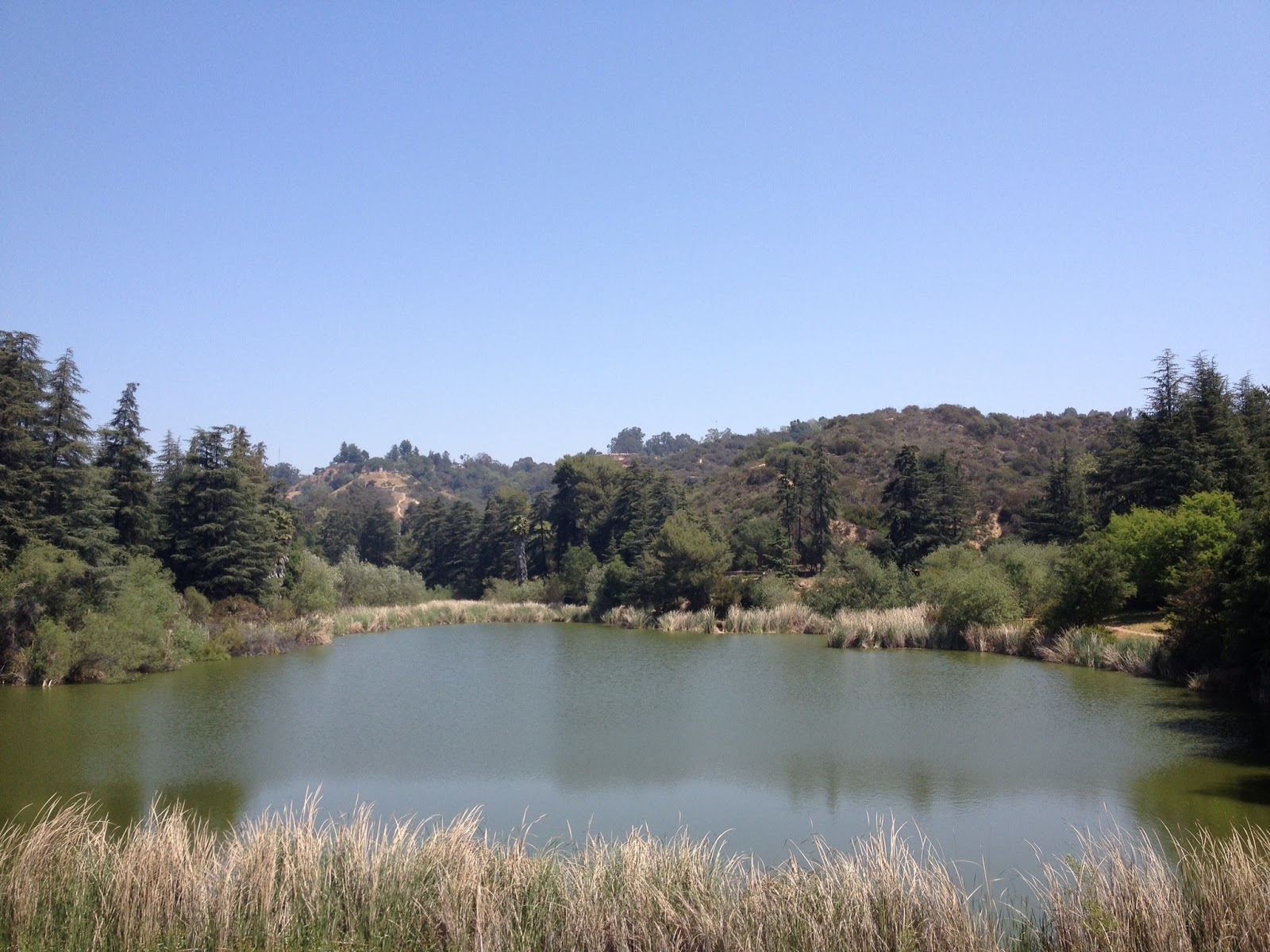
parker mesa trail has a gain in both directions, so there's no steep hike one way and a fully downhill hike on the way back. the point overlooks santa monica bay and there are a few benches for your to enjoy your snacks and take a water break. we were lucky enough to get caught in a runaway cloud as we were leaving the point. it was an unreal experience!

parker mesa trail
the trek:
- drive up entrada road for 1 mile to get the park entrance
- walk through the park and stay straight after the guard shack, going towards the large parking lot
- stay to the left and head towards the fire road
- head up the fire road and turn right onto parker mesa trail (about .5 miles)

santa monica bay, view from overlook

total distance: 7 milestravel time: 2h30m
gain: 560 ft
difficulty: moderate

stuck in the clouds
the tips:
- park on entrada road outside of the entrance (be sure to be FULLY off of the pavement to avoid a ticket)
- hit the bathrooms inside the park at the bottom of the fire road before you begin
- pack a snack to enjoy once you get to the overlook


Monday, May 13, 2013

trails - betty b dearing

also off mulholland, the betty b dearing trail starts from the nancy hoover pohl overlookparking is free in the lot. this trail leads you down the mountain to a jungle ravine. if you keep on trekking, you'll end up at the base of fryman canyon trail.

the trek:
- from the parking lot, walk down trail about 30 feet
- at the fork, stay to the left and go down the hill into the trees
- keep heading down until you get to a T
- hang a left to go towards the "jungle"
- the "jungle" area is complete with a small creek and fallen trees
- if you keep following the trail out of the jungle, you will reach base fryman canyon in .7 miles


inside the jungle

total distance: 4+ miles
travel time: 1h15m
gain: 400 ft
difficulty: easy to moderate
wilacre park - betty b dearing trail
the tips:
- dog-friendly trail
- there's a lot of tree coverage and trail get get a bit chilly

trails - franklin canyon

just southwest of the mulholland and coldwater canyon intersection is franklin canyon, a beautiful park hidden in the middle of los angeles. the park has a duck pond, a few trails and park spaces you can rent for private parties. there's a lot of tree coverage before you hit the trails and plenty to explore without making a climb. we wandered around the park for a bit before we got to hastain trail.

the trek:
- from the parking lot, walk down the main road until you reach the pond
- walk around the pond, keeping it on your left
- after you circle the pond, get back on the main road and follow the signs to beverly drive
- turn left onto lake drive
- hastain trail entrance on your left
- once you reach the peak, head back the way you came
- about 1/4 mile back down, you'll see an unmarked trail sign straight ahead of you
- take the trail to head back down and you'll end in a park
- stay to the right as you walk through the park and you'll end up back on lake drive

duck pond
view of west LA from hastain trail peak
total distance: 5.5 miles
travel time: 2h00m
gain: 680 ft
difficulty: moderate

franklin canyon - hastain trail

the tips:
- park in the main lot, to the left of the entrance sign
- wear a hat, as the trail offers no shade
- the trail gets steep in some areas, so bring plenty of water
- the trail is mostly gravel and sand with steep areas so wear proper shoes to avoid slipping

Tuesday, May 7, 2013

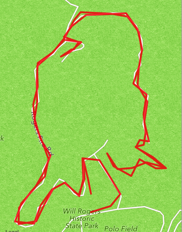
trails - will rogers

on the west side of town and right off sunset blvd sits will rogers park. there are 3 trails to explore in the park, including the popular inspiration point trail below. this trail offers beautiful views of the palisades and the pacific ocean.

the trek:
- head up to the visitors center, near the bathrooms
- climb the stairs to the trail and you'll see the marker for inspiration point 30 feet ahead
- turn left up the trail
- when you get to the end of the trail, turn around and go back up and over to get a 4+ mile hike


panoramic view from peak of inspiration point
total distance: 4.4 miles
travel time: 1h15m
gain: 515 ft
difficulty: easy to moderate

will rogers - inspiration point trail
the tips:
- skip the $12 parking lot fee and park along the side of the road before you get to the entrance
- bring picnic supplies to lounge in the grassy park after your hike
- come back to the park for a polo match


Wednesday, April 3, 2013

trails - point lobos

point lobos is a peninsula just south of carmel. it was a whaling hot spot in the late 1800’s and a blockbuster backdrop until the early 1990’s when it became part of the monterey bay national marine sanctuary.


there are many trails to choose from at point lobos. we were on a bit of a time crunch and couldn’t commit to the 6 mile perimeter loop, but ended up on a 4 mile tour of the point instead.

the trek:
- carmel trail
- granite point
- cabin trail
- north shore
- east grove
- sea lion point
- south shore trail
- piney woods
- lace lichen

old whaler's cabin

whaling cove

view from north shore trail

sleeping sea lions (bottom left)
total distance: 4 miles
travel time: 1h20m
difficulty: easy to moderate

the tips:
- skip the $10 parking lot fee and park along hwy 1
- give yourself at least 1 hour for photos; trust me on this one
- go in january or february to spot whales in the peak of migration


Tuesday, February 19, 2013

trails - black sand beach at ragged point inn


after the first time I walked barefoot in the thick green grass, I knew I had to plan another journey back to ragged point inn. the daydreaming and researching paid off, as I was pleasantly surprised to discover there was a trail down to a black sand beach and waterfall on the property.
view of the beach

the trek:
- walk to the northern coastal edge of the property, behind the convenience store
- the trailhead is the unmarked path next to the scenic gazebo lookout
- head down the stairs and keep going down

black sand beach
the waterfall - sad, but pretty
total distance: 1.2 miles
travel time: 25 minutes
difficulty: moderate

the tips:
- wear shoes with good traction, the trail can be very muddy
- pack a post-hike picnic to enjoy on the lawn

view from picnic spot


trails - pch


southern california is amazing, but driving up the coastline to the northern cities is by far my favorite adventure in this state! i recently ventured up to the city of carmel by way of highway 101 and pch. magical! i’ve done this trip a few times. sometimes it takes 6 hours, sometimes it takes 12.

northbound on pch
the trek:
- jump on the 101 until you get to xxx; yes the coastline is beautiful at the channel islands and santa barbara, but this route is fairly coastal and avoids heavy traffic areas and farmlands
- plan a rest stop at avila valley barn in xxx and pick up some homemade ice cream or local apple cider
avila valley barn
- tour hearst castle in san simeon; be sure to book your tour online in advance
- head 12 miles up the road to the elephant seal sanctuary
- stretch your legs on the waterfall hike at ragged point inn
- grab some sustenance at big sur bakery; be sure you make it there before 4pm, they close early!

- enjoy the beauty of julia pfiefer state park
- check out more trails at andrew molina state park
- grab a shot of the famous bixby bridge
bixby bridge
- take in the monterey coastline at point lobos
- book a whale watch in monterey
- circle back and snuggle into a bed & breakfast in carmel

total distance (from los angeles):
travel time: 6 – 12 hours, depending on stops and traffic
difficulty: peaceful, scenic driving at its best

the tips: call the dot news update line to find out if pch is closed along your route before you hit the road.

intro


here i am, entering the blogosphere; making my small splash in the ocean that is the internet.

i know we all have our own personal interests, so i have decided to dedicate this blog to mine: tunes, trails and treats.

i really want this to count. i want to be helpful. i want to provide tips to all of the things i find amusing.

here’s the word:

tunes - i love music. i love concerts. i love discovering new artists. i love supporting local musicians.

in this section i will highlight some of my favorite bands, feature up-and-coming artists, give you the scoop on must-see local los angeles shows and showcase my latest mix tapes. there may even be a free download or two, if you’re lucky.

trails – i love being outside in the sunshine. i love walking barefoot in lush, green grass. i love having a bird’s eye view. i like escaping from the city and exploring all that nature has to offer.

in this section i will give a rundown on recent trails i’ve explored. i will share handy information like distance, duration, difficulty, and any helpful hints i discover along the way.

treats – i love baking. i love gifting baked goods. i love experimenting with traditional recipes and putting my own spin on things. i love creating tasty food from scratch.

in this section i will share some of my favorite recipes i’ve created or have discovered over the years. i’ll be focusing on baked goods and desserts, but will feature the occasional savory item. be on the lookout for healthy recipes, too. you gotta have a balance, right?

cheers!
@sparsells